Sabah Water Resources — Rivers, Dams & Water Supply
Sabah is shaped by its rivers. The Kinabatangan (560 km) is the longest, anchoring a 28,000-hectare wildlife sanctuary, while the Padas powers the Tenom Pangi hydroelectric dam. Kota Kinabalu draws its water from the Crocker Range watershed, and the whole system is governed by the Sabah Water Resources Enactment 1998 through DID Sabah and the Sabah Water Authority (LANS).
Major river systems
Sabah’s landscape is drained by a network of rivers running off the central ranges to the South China Sea in the west and the Sulu and Celebes Seas in the east. These rivers are more than waterways — they are wildlife corridors, transport routes, hydro-power sources, and the basis of the state’s water supply.
| River | Length / extent | Key feature |
|---|---|---|
| Kinabatangan | 560 km | Longest river in Sabah, second-longest in Malaysia; major wildlife corridor |
| Padas | 165 km | White-water rafting; powers the Tenom Pangi hydroelectric dam |
| Sugut | Major eastern river | Part of the eastern river and tributary system |
| Labuk | Eastern coast | Serves the Beluran and Telupid areas |
| Segama | Southern Sabah | Flows through the Danum Valley area |
| Papar | Western coast | Flows through Papar district |
| Klias | Western | Klias wetlands and firefly sanctuary |
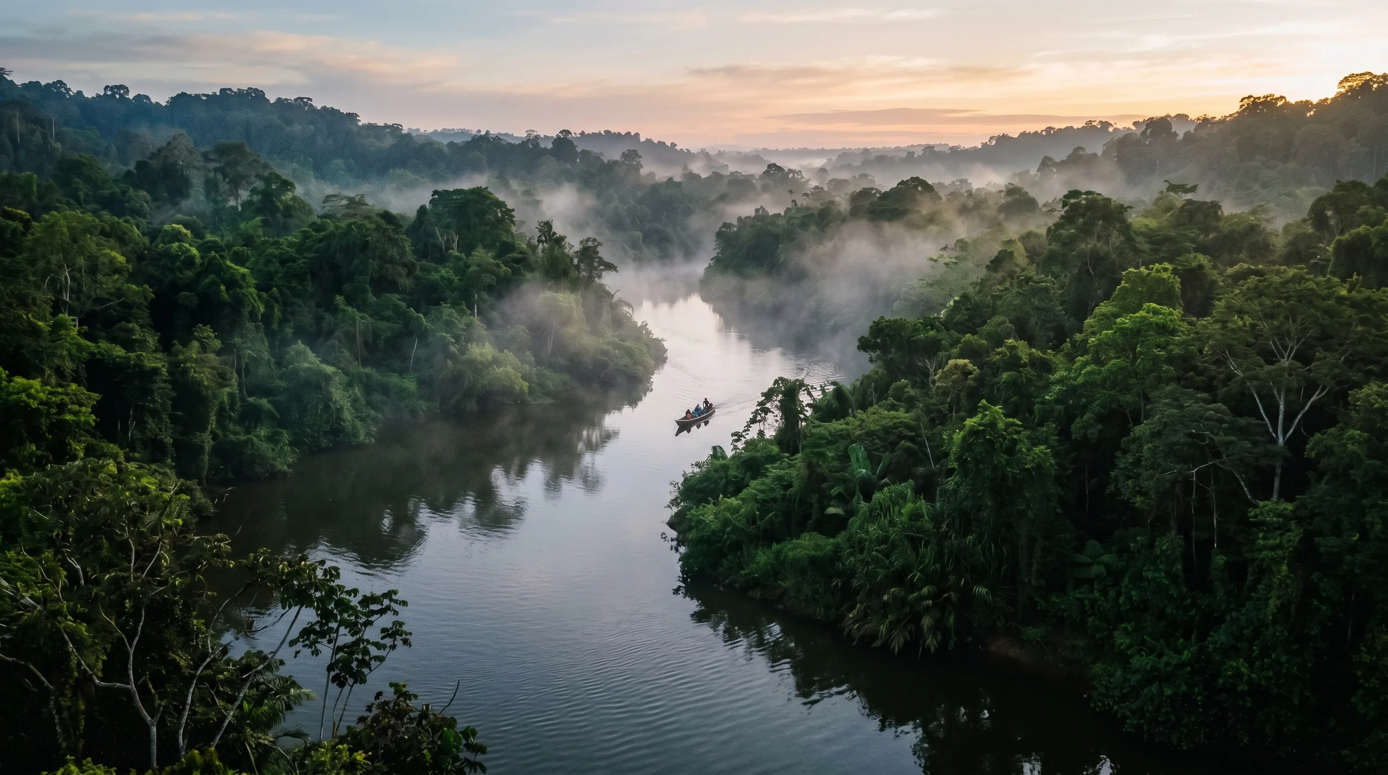
The Kinabatangan Basin
The Kinabatangan is Sabah’s defining river. Its lower floodplain — a maze of oxbow lakes, riverine forest, freshwater swamp and mangroves — supports one of the densest concentrations of wildlife in Southeast Asia. The Lower Kinabatangan Wildlife Sanctuary, gazetted at 28,000 hectares in 1999, has been put forward as a candidate UNESCO Biosphere Reserve. Nearby, the limestone caves at Gomantong are famous for their swiftlet nests and bat colonies.
That same floodplain is vulnerable. The 2000 flood caused an estimated RM45 million in palm oil losses across roughly 15,000 hectares of plantations — a reminder that managing the basin means balancing agriculture, conservation, and flood risk.
The lower Kinabatangan around Sukau and Bilit is the most reliable place in Sabah to see pygmy elephants, proboscis monkeys, and orangutans from a river boat. It pairs naturally with our biodiversity and forests data pages.
Dams and hydroelectric power
Sabah’s main hydroelectric facility is the Tenom Pangi Dam on the Padas River, about 120 km south of Kota Kinabalu. The Padas is a double act: it generates power and is also the state’s premier white-water rafting river. Beyond Tenom Pangi, the state has deliberately limited large new dam development, prioritising water security and irrigation instead. Protecting the Crocker Range watershed — the primary water source for Kota Kinabalu — is the cornerstone of that approach.
How water is managed
The legal framework is the Sabah Water Resources Enactment, passed in August 1998 to govern how the state’s water is planned, allocated and protected. Two agencies carry it out:
- Department of Irrigation and Drainage (DID) Sabah — planning, water allocation, river-basin protection, and flood mitigation (did.sabah.gov.my).
- Lembaga Air Negeri Sabah (LANS) — the Sabah Water Authority, responsible for potable water supply, billing, and rural water construction.
The overarching policy theme is water security: protect the catchments that supply the cities, manage flood risk on the big floodplains, and extend reliable piped water into rural districts.
Frequently asked questions
Q What is the longest river in Sabah?
Q Where does Kota Kinabalu get its water?
Q Does Sabah have hydroelectric dams?
Q What is the Lower Kinabatangan Wildlife Sanctuary?
Q How is water managed in Sabah?
Q Do Sabah’s rivers flood?
Sources & References 5 sources
Last verified: 22 June 2026
Government — Water & Drainage
- Department of Irrigation and Drainage (DID) Sabah Water resource planning, allocation, flood protection and river-basin data
- Lembaga Air Negeri Sabah (LANS) Sabah Water Authority — potable supply, billing and rural water construction
- Sabah State Government Portal State enactments including the Water Resources Enactment 1998