Mount Kinabalu Stats 2026 — 4,095m, Climbers & Ecology
Mount Kinabalu is 4,095.2 metres — Southeast Asia\u2019s highest peak. Kinabalu Park covers 754 km² and holds UNESCO World Heritage + Biosphere + Geopark status (13 criteria met). Annual climbers: ~50,000 (2024, recovery). Daily limit: 163 permits. Standard climb: 2 days, 1 night. Species: 5,000+.
Climber numbers collapsed post-2015 earthquake (June) and stayed near zero through COVID (2020–2021). Recovery is strong — 2024 exceeded pre-pandemic levels.
Source: Sabah Parks annual statistics
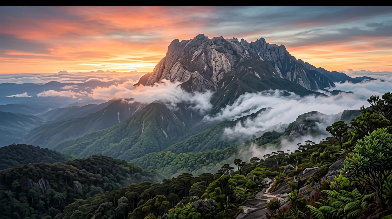
Southeast Asia\u2019s Highest Peak
Mount Kinabalu (4,095.2m) is the highest mountain between the Himalayas and New Guinea. It stands on the island of Borneo, within Kinabalu Park — Malaysia\u2019s first (and one of the world\u2019s most biodiverse) national parks.
The mountain is climbable by non-climbers, requiring only fitness and determination — no ropes, harnesses, or technical rock climbing skills needed. However, altitude, thin air (70% oxygen at sea level), and the pre-dawn summit push (2:30am start) make it challenging.
Kinabalu Park: 754 km² of Biodiversity
Mount Kinabalu hosts 5,000+ vascular plant species — nearly one-third of Borneo’s total. Orchids, pitcher plants, and rhododendrons are the stars.
Source: Kinabalu Park research, Sabah Parks
Kinabalu Park (754 km²) spans from 1,500m to 4,095m, encompassing distinct ecological zones:
- Lower montane forest (1,500–2,500m): Cloud forest, fern-rich canopy. Kingfisher species, endemic birds.
- Upper montane forest (2,500–3,500m): Stunted forest, ericaceous shrubs (heather-like). Transition to alpine.
- Alpine meadows (3,500–4,095m): Sparse grass, lichen-covered rocks. Only 5–10% of tropical mountain biodiversity found here, but every species is endemic.
Climber Statistics
Malays account for 55% of climbers. International visitors are dominated by UK and US tourists, plus Asian source markets (Japan, Korea, Singapore, China).
Source: Sabah Parks visitor data
~50,000 climbers annually attempt Mount Kinabalu, with roughly 55% being Malaysian and 45% international. Peak season (Feb–Apr, Sep–Dec) is hardest to book — permits sell out 9 months ahead. Success rate is ~95% for those reaching Panalaban — failures are mostly weather-related or medical issues above 3,000m.


Geology & Significance
Mount Kinabalu is geologically young (7–8 million years old) and is the youngest granitoid intrusion in Southeast Asia. It is recognized by UNESCO as having exceptional geological significance and is one of the IUGS\u2019s 100 global geological heritage sites.
The mountain rises from lowland tropical conditions to ice-covered peaks — an extreme range of climates and habitats within a short distance, leading to extraordinary biodiversity concentration.
Climbing Routes & Facts
- Timpohon Trail (standard): 1,866m start, 4–5 hours to Panalaban (3,272m). Used by ~95% of climbers. Well-maintained, reliable water sources.
- Ranau Trail (summit): 1.27 km from Panalaban to Low\u2019s Peak. No daily limit. Harder; steeper. Damaged in 2015 quake, upgraded since.
- Kota Belud Trail (summit): 1.1 km from Panalaban. Limit 30 climbers/day. Harder grade, 1:3 guide ratio.
- Via Ferrata — Walk the Torq: Beginner route at 3,520m with suspension bridge. "If you can climb a ladder, you can do it."
- Via Ferrata — Low\u2019s Peak Circuit: Advanced, world\u2019s highest certified via ferrata. 4–6 hours, adrenaline rush at altitude.
Frequently asked questions
Q How hard is the Mount Kinabalu climb?
Q How long does the climb take?
Q When is the best time to climb Mount Kinabalu?
Q What happened in the 2015 earthquake?
Q What is the altitude sickness risk?
Q Can beginners climb Mount Kinabalu?
Q What is the daily climber limit and why?
Sources & References 4 sources
Last verified: 11 April 2026